Main

20 April 2006

Devizes to Westminster 2006 report

After two and a half months of training, mental preparation and logistical planning we arrived at Devizes Wharf on Saturday morning, together with our support team, bristling with anticipation for the race ahead.
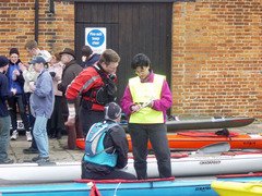
Mattias and John check in with the scrutineers (click to enlarge)Crews time their start to arrive at Teddington for high tide so the wharf was considerably less busy than the last time we were here, at the start of Waterside D, as many people would already have started or would do so later in the day. None the less, there was a palpable air of excitement as we carried our boats into the scrutineers’ enclosure for a final safety check.

After good luck wishes and a team photo with our supporters we put in and made our way to the start line. At 09:26:30 we set off, just a few minutes after our planned departure time.

Shortly after the start we encountered 'Saddam' the swan. We carefully paddled past the hissing beast and thought we had avoided his wrath but when we had gone about 100 metres I heard an ominous beating of wings behind me. We paddled harder as it grew louder until the crazy bird flew straight into my back. I resisted the temptation to take a slice at his neck with my sharp carbon fibre paddle blade and he clung onto the back deck for a few seconds before finally letting go.
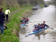
The first support stop at Honey Street (click to enlarge)
There are no portages for the first 14 mile ‘pound’ to Wootton Rivers so we had arranged to meet our support teams at Honey Street (8 miles) and Pewsey (12 miles). The first stop went to plan and we had a slick change of drink bottles.

At the second stop, however, as we reached up to the high wharf to change the bottles Julien and I lost our balance and capsized. We were a bit embarrassed but no harm was done and we quickly dried out as we paddled on towards our first real challenge: Crofton (18 miles).

The Crofton Flight is a series of seven locks spread over about a mile which most crews portage, running with the boat on their shoulders. While John and Mattias are strong runners, Julien and I knew we would struggle with this section and so we had all agreed to paddle a couple of the longer pounds.

After Crofton our next target was Newbury (34 miles). This was the furthest distance that any of us except Mattias had ever paddled in a single day and in my mind I had been thinking of it as the start of the race proper.

After the exertion of Crofton I found the section to Newbury very hard as this is where the portages are at their densest (there are 35 locks in the 20 miles between Wootton Rivers and Newbury).

Portages were never a strong point for Julien and I and at each one we would see John and Mattias leap out and run around the lock, usually paddling away as we reached the put in. We would then work hard to catch them just in time for the next portage where the same thing would happen all over again.
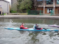
John and Mattias arrive at Newbury (click to enlarge)By the time we reached Newbury after nearly seven hours I was feeling exhausted and emotional. While the support team fed us and congratulated us on our progress so far I just wanted to cry.

Things gradually improved as we continued toward Aldermaston (43 miles) and the last part of the canal section that any of us had paddled on before. The new terrain and the increasing distance between portages helped my morale and Julien and I began to find a good strong pace without the frequent interruptions for tiring portages. It was also, by now, a beautiful spring evening and I thoroughly enjoyed this section.

The next milestone was Reading (54 miles) and the end of the canal. Like most crews, we had planned on a full kit change and a hot meal here and as we got nearer I think Julien must have smelled dinner and he picked up the pace. We arrived at about 20:00 to a mass of supporters and crews all relishing what, for most of us, would be the one break in the race.
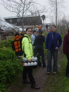
Yolanda and Sam, just two of our superb support team (click to enlarge)Thirty minutes later, feeling much more comfortable in dry kit, we set off in darkness on the Thames.

At this stage I felt quite intimidated by the dark and the long night ahead. We are nocturnal paddlers and most of our training in London has been on the Thames and the Regent’s Canal at night but it did not prepare me for the pitch black of the rural river. I was also very conscious of the fact that ninety percent of retirements happen between Henley and Windsor and I viewed this section as the crux of the paddle.

Once again, Julien and I found a good strong pace helped by the slight flow on the river, the deeper water (which results in less hull drag) and the longer distances between portages which were now three to five miles apart. In fact, the portages were now perfectly spaced to be welcome breaks rather than the irritating and tiresome interruptions of the canal and our night time supporters did a fantastic job of meeting us at nearly all of them.

While Julien and I were going from strength to strength, John and Mattias were beginning to struggle, although we did not realise this at the time.

At Hurley (68 miles) we were held up at the portage and they got several minutes head start on us. When we set off we picked up the pace to catch up with them. Despite taking a wrong turn and having to come back on ourselves, we caught them in about three miles and I wondered if they had slowed for us to catch up.

Our pace was now so good and so comfortable that we kept it up and when I turned around at Cookham (74 miles) expecting them to be right behind us there was no sign of them. This was my first hint that something was wrong.

We waited as long as we could but we were starting to get cold as it was now about 00:30 and we set off just as they reached the put in after the portage. At the next lock, Boulters (77 miles), Mattias told us that John had stopped to be sick. I thought nothing of it and assumed he would feel better afterwards.
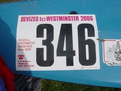
I will not forget this number in a hurry (click to enlarge)I enjoyed the next leg from Boulters through Maidenhead to Bray (79 miles) as it is very familiar to me and I was happy to be able to give Julien, sitting in front, a bit of steering guidance and even some local history.

At Bray we stopped for some very welcome coffee and waited for John and Mattias. When they arrived Mattias told us that we should activate ‘Plan B’. I was shocked.

From the outset we had planned to paddle the race as two crews together to support each other through the inevitable low points but acknowledging that if one crew had a serious problem we might have to split up.

Julien and I had not appreciated the severity of the problem the others were suffering but John was now dehydrated and being fed dioralyte solution, he desperately needed calories but could not keep anything down and he was cold.

Mattias bravely told us that we should go ahead and that they would slow down and aim for the evening tide at Teddington. Reluctantly, and with a sinking feeling about their chances, we set off alone.

We were now almost at Windsor (84 miles) and over half way through the non tidal section of the river, it was 02:00 and we were both surprised at how good we were feeling. I also realised now that, providing we were careful and nothing went wrong, we should make it.

My focus shifted from getting over the night time crux to reaching Teddington (108 miles). Teddington is the milestone. From here the Thames becomes tidal and one can almost float down the last 17 miles to Westminster with the tide.

I knew, however, that our schedule had slipped a bit and that the tidal barrage at Richmond, three miles downstream of Teddington, would probably be raised two hours after high tide at around 07:00, just as we would be getting to Teddington. This meant we would have a little further to go to catch the tide and an extra portage (after seventy seven one more would be no hardship).

So from Old Windsor Lock (87 miles) I was focused on one thing: getting to Teddington. The next twenty one miles would get harder and harder and I began to feel the first twinge of tendonitis in my right (control) wrist. This is the curse of paddlers and I knew it could become a problem so I redoubled my efforts to fully open my hand on the pushing part of each stroke.
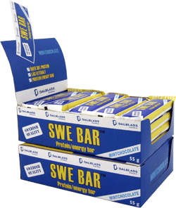
SWE bars. Mattias secured sponsorship for us from a Sweedish power bar manufacturer and they kept us going throughout the raceNow our pace began to slow a little and we were disheartened not to find a support crew at a couple of locks as our fuel was running low. One kind supporter of another crew gave us some coffee and we tapped our emergency supplies of Kendal Mint Cake which kept us going.

When we next met our supporters, Dave and Yolanda, they told us the inevitable news that John and Mattias had retired. They made it as far as Old Windsor (18 hours, 37 minutes and 87 miles). I did not allow myself to dwell on this too much except to think that we had to finish for them.

Dave reeled off the names of the last few portages we had to get through before Teddington, telling us it was only a handful more. I knew he was exaggerating how few portages were left and glossing over how many actual miles were involved but we soldiered on.

At around 05:30 it started to get light and while this gave us a definite lift it also had a downside. After Molesey (103 miles), the last lock before Teddington, the daylight exposed the river stretching out seemingly endlessly in front of us after every bend with no hint of a lock.

By now my arms were starting to tire and I knew I was running out of fuel. Every stroke became harder than the last and I could see that there were many more to go. This five mile stretch from Molesey to Teddington was, for me, the hardest part of the race. Forcing myself to keep paddling took an effort of will I would not have thought possible.

I kept thinking that if we could only get to Teddington I could stop and rest, until the next tide if necessary. In fact, I began to form a negotiating strategy to use with the support team. I would tell them I was going to wait for the evening tide and then let them beat me down to an hour’s rest which I figured was the most we could afford if we were to catch the morning tide.

Finally, we rounded a bend and saw what I almost dared not hope was a lock in the distance. We pulled in to the bank and I dramatically announced that I could go no further. Julien turned around in the boat and gave me a quizzical look. I felt pathetic.

The supporters rallied round and fed me hot soup, power bars, glucose tablets and Nurofen. Yolanda threatened to call my wife, Deborah, and tell her to talk me back onto the water. Then Mattias and a very tired looking John arrived to add their encouragement. I knew I would go on and that I was certainly not going to let everyone down at this stage.

After a few more minutes rest we portaged the lock and set off for Richmond. Julien pointed out that it was now just a Sunday morning paddle and as the calories kicked in my strength returned and I knew he was right.

After Richmond and the tidal barrage we really started to fly and as the sun came out and the church bells rang in Easter Sunday I felt there was no better way to be coming home to London.

Normally when we paddle on the Tideway we keep close to the bank and out of everyone else’s way but on this Easter Sunday morning it was our river and we paddled right down the middle to get the maximum tidal assistance.

The supporters cheered us on at several bridges and, although our paddling slowed a bit in the last five miles, the tide kept us moving fast and soon we began to see landmarks that meant the end was near: Millbank Tower and the London Eye in the distance.
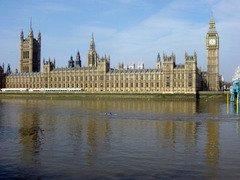
About to cross the finish line under Westminster Bridge (click to enlarge)When Lambeth Bridge came in to view I smiled to myself. We have often paddled here from Wapping in training and always imagined ourselves finishing DW as we paddled the short reach from here back to Westminster Bridge.

Big Ben struck 10:00 as we crossed the finish line 24 hours, 34 minutes and 125 miles after we had set off from Devizes. We had finished a creditable 33rd of the 115 crews who had started the race but all that mattered was that we had finished.

As we were lifted out of the boat by cheerful fellows in dry suits my spirits soared and Julien and I hugged each other and all of our supporters, who had gathered on the beach by Festival Pier.

The knowledge that we did DW is still sinking in and it gives me a thrill every time I think of it. This race is by far the toughest thing I have ever accomplished and I could never have done it alone.
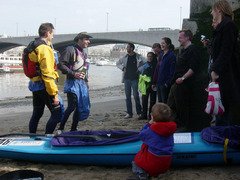
Champagne reception with our support team and Bart (click to enlarge)Thank you Julien. You were a machine. I was just about able to follow your pace but I could never have set it.

Thank you John and Mattias. Without your enthusiasm and camaraderie I would never have persevered through the freezing night time training on the canal and without your planning and organisation we would never have got to Devizes.

Thank you Yolanda, Dave, Helen, Alison, Mishi, John, Sam, Andrew and Craig. You guys were fantastic. There is no doubt that DW is a team event and you were there supporting us every stroke of the way.

Thank you Barking and Dagenham Canoe Club. When we were floundering in our search to find suitable boats in time for training and the race we were taken aback by the generosity of your offer to borrow a pair of stable K2s. They have suited us perfectly.

Finally, thank you Deborah and Bart for putting up with this mad scheme over the last three months.
6 December 2005

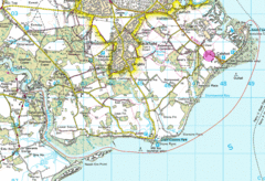
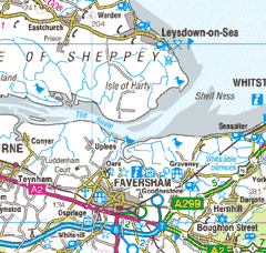
The Swale

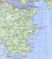
Map of the Swale
Saturday saw a group of eleven paddlers from THCC get out on the Swale estuary in Kent.

The forecast was for quite strong south westerlies with showers and the risk of a thunderstorm. On the whole the location was quite sheltered but we did experience one ferocious squall as we headed back up the estuary to the Harty Ferry Inn on the Isle of Sheppey for lunch. We were paddling into a force 3-4 already and we could see some menacing dark weather coming towards us. All of a sudden the squall was upon us and it was as if a switch had been thrown. The waves quickly grew in size and white crests appeared all around us, we battled ahead straight into the wind barely moving forward, despite some tidal assistance. After about ten minutes the squall passed as quickly as it had arrived and we were rewarded with a hearty lunch!

In the afternoon the sun came out and we explored Oare creek, returning to the very convenient access point at Harty Ferry South just before sunset.

14 November 2005

Margate

Margate sunset
On Saturday a group from THCC headed for the north Kent coast and after a bit of car shuffling set off from the beach in front of the Continental Hotel in Whitstable at 12:15. We could not have asked for much better weather, given the time of year: the wind was a gentle south westerly of about force 2 and the sea was calm. We also had the ebbing tide helping us along and made quick progress despite an unhurried pace.

Our first stop was to explore the remains of the pier about 1 km off-shore Herne Bay, we then paddled on, landing on the beach just to the east of the ruined church towers at Reculver for lunch. After lunch we made for Margate and got there in the dark at about 16:45 having enjoyed a spectacular sunset behind us with the silhouette of the ruined church towers adding a dramatic element to the view.

Total distance was about 25km.

18 July 2005

Solent crossing

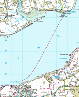
Lepe to Newton Bay (click to enlarge).
On Sunday we made a crossing to the Isle of Wight, setting off from the beach at Lepe and landing at Newton Bay. The conditions were even calmer than the previous day and I enjoyed overtaking yachts which were drifting with the current with all sail up hoping to catch a breath of wind!

On this trip we practiced using tidal stream vectors to navigate across the Solent taking into account the tidal stream of about 1.6 knots. To my surprise, paddling on the calculated bearing brought us to within ten metres of the buoy that we had selected as a destination.

After a leisurely lunch we paddled back across to our launch point, again using a bearing to offset the tidal stream and with similarly accurate results. We then spent some time getting wet practising rolls and rescues and enjoying the warm water before packing up to face the traffic back to London.

Total trip distance was 16 km.

Calshot to Buckler's Hard and back

Calshot to Buckler's Hard (click to enlarge).
It has been ages since I had a chance to get off the river and paddle at sea but at the weekend a group from our club made a trip to Calshot, near Southampton.

On Saturday we paddled from Calshot out into The Solent, past Lepe and on up the Beaulieu River, where we stopped for lunch at Buckler's Hard before heading back the way we had come.

Coffee break at Lepe (click to enlarge).
I normally think of sea kayaking as a way to get away from it all but this was certainly not the case in The Solent on a sunny Saturday in July! We kept clear of the shipping channel and most of the yachts but inevitably suffered from a bit of jet ski and power boat noise pollution.

The trip was mostly a very gentle paddle but we did enjoy catching some waves on the way back as the wind had increased to a Force 4.

Total distance was 28km.

5 September 2004

Cwm Pennant Festival - Abersoch trip

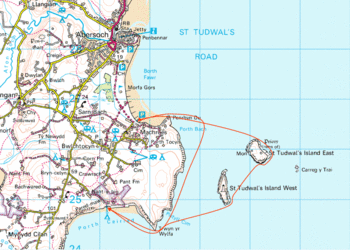
Abersoch mapWe pushed off from the beach at Sarn Bach, just south of Abersoch, in scorching sunshine with the dark mountains of Snowdonia looming up across the bay to the east. We were the last group of paddlers to set off and, led by Dave Evans, about twenty of us paddled south, around the cliffs towards the headland of Trwyn yr Wylfa and around to the beach at Porth Ceiriad. On the way we spotted a porpoise, easily distinguished from a dolphin (after the lecture we had received on Saturday) by its triangular dorsal fin. The conditions were ideal with little wind and calm, clear water but we did experience a lot of wake from the numerous jet skis and speed boats.

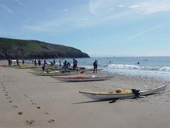
landing at Porth Ceiriad
Despite being the last to set off, we were the first group to arrive at the beach as the others were making the trip around St Tudwal's Islands. There was some breaking surf on the beach and those who landed first stood by to help the rest in. Having hauled the boats up on the sand we sat down to enjoy our picnic.

If the other people on the beach had been surprised to see twenty kayakers arriving, they must have felt they were being invaded, when, twenty minutes later, the rest of the paddlers began to arrive. From our picnic spot we were entertained by some spectacular surf landings and soon the number of boats lined up on the beach had grown to sixty five - an armada!

While the others were finishing their lunch I had a refreshing swim and we all then got back in to our boats and headed off to explore St Tudwal�s Islands, the site of the sixth century saint�s hermitage and a well known seal colony.

Setting off after lunch
We paddled past the southern end of the west island and across to the east island where we rested for a few minutes to explore the caves and admire the scenery. I saw only one seal as we rounded the south east corner of the island.

The eastern side of the island is evidently a popular spot with locals as lots of boats had dropped anchor there and people were swimming or lazing on deck reading the Sunday papers. We paddled through the boats and straight back across the channel, delighted to find that an ice cream van had arrived at the car park!

Total trip distance 11km. More pictures of this trip are available here.

7 August 2004

Seven Heads trip

Earlier in the week I had made arrangements with Jon Hynes of H2O Sea Kayaking to join him and four other paddlers, Noelle, Gerard, Rob and Susan on a weekend expedition. The provisional plan was to paddle around the Seven Heads on Saturday, camp and go on towards Clonakilty on Sunday. On Friday Jon rang and asked if I had been watching the weather forecasts as the tail end of Hurricane Alex was stirring up a storm due to pick up from the south east at some time on Saturday afternoon. He suggested we get started as early as possible on Saturday to make the most of the available weather window but accepting that we might have to pull the plug at any stage.

Map of The Seven Heads.We set off from Coolmain beach and made directly for Barry�s Point across Coolmain Bay. The crossing was sheltered by The Old Head of Kinsale as the wind was in the south east and the small waves made it possible to paddle together in twos or threes chatting but we could see larger breaking waves � a sign of things to come - on Horse Rock as we approached Barry�s Point.

Once past the point we regrouped head to wind and swell, to discuss the next section. Jon explained that we would paddle across Seven Heads Bay towards Vregira Point, then past another couple of headlands to Leganagh Point. From there, he explained, we would have about two kilometres which he described as the crux of the trip in that there was no landing place and we would have to keep paddling.

We made good progress across Seven Heads Bay with the swell growing as we lost the shelter of The Old Head. Now we were paddling directly across the waves having to lean into them as they approached the side of the boats and adopting a longer paddle shaft on the windward side to counter the wind and swell that was tending to turn us towards the shore.

As we rounded Vregira Point we passed a yacht going the other way just outside us, we exchanged waves and I imagined how mad they must think us to be out in what were now developing into quite adventurous conditions. From Vregira Point and beyond we found the waves increasingly large and confused around each headland with evident clapotis. This made it ever more difficult to predict which direction the next wave might strike from and heightened the need for constant observation all around one (while I was busy watching the waves Rob managed to spot a sunfish as we rounded Illaunbaun).

After we passed Reenreagh we again regrouped facing together into the waves and paddling slowly to hold our position. Jon checked how everyone was doing and I told him I was a little nervous of the growing swell and that I was suffering from a stiff right leg (I was afraid of cramp and had been trying to stretch and straighten it whenever the waves did not seem too threatening). Jon explained that we were now entering the crux and that once past the next headland (Leganagh Point) we would keep going quickly towards Dunworley Point which we could see adorned by a fortification set back from the tip of the promontory.

Fortification above Leganagh Point as seen from Dunworley Point.
By the time we rounded Leganagh Point the swell had grown to about 1.5 metres and was coming from behind us across the windward quarter, this made things quite tricky as one could not see what was coming. Despite frequent glances over my left shoulder, there were inevitably some bigger waves that hit me unsighted requiring swift corrective action. At one point, a large wave broke right over me. I instinctively made a strong low brace into the wave on my left hand side and stayed steady while the water crashed over me. Jon and Noelle saw this and congratulated me on my brace. I had not seen the wave coming, as perhaps they had, and did not think it noteworthy but was glad that I had not lost my instinctive paddling skills.

I found the next section, the crux, much more threatening. This was not due to any immediate danger, but rather, to the intense and sustained concentration required to paddle a course, stabilising the boat as necessary, while watching out for waves from behind and keeping in contact with the rest of the group.

By the time we reached Dunworley Point I was longing for a break, not because I was physically tired, but just to be able to relax my concentration for a few minutes.

Rounding the point was again quite an anxious moment as the sea state had been steadily increasing and we were now very exposed. We were past the crux as we could have got in to Foilareal Bay but Jon had decided to go another 1.5 kilometres to Dunworley Bay which was a preferable camp site.

Channel between Bird Island and the headlandOnce around the point we cut across the small bay and made for the narrow channel between the headland and Bird Island. Jon went in first and found a position facing outwards where he could hold station and call the rest of us in one by one whenever there was a break in the waves. When my turn came my adrenaline surged as I paddled like mad for the calm water beyond the rocky gap, silently uttering a prayer that I would get there before the next wave.

I negotiated the channel safely and passed into the sheltered water behind Bird Island. Finally, I was able to relax and I drifted gently for a minute with my paddle resting across my boat feeling slightly giddy as my nervous energy dissipated.

Channel between Bird Island and the headland
When the whole party was safely through we laughed and congratulated ourselves and found an even more sheltered spot in a sea cave where we were able to stop, admire the scenery, share some coffee and take pictures.

After a little rest we paddled out of the cave and into the calm water of Dunworley Bay taking time to explore another dramatic sea arch on the way in to the slipway beneath our camp site. Again, Jon went in first calling us each in turn onto the slipway, between the bigger waves, from where we carried the boats up to some conveniently located picnic tables for lunch.

Breaking waves at Dunworley beach on Sunday morningOur total distance travelled for the day was about 14 kilometres.

On Sunday morning the sea state had risen substantially and Jon made the decision to abandon any further hope of paddling as launching, let alone landing, through the surf would be too challenging.

Additional photos from this trip are available here.

1 August 2004

Old Head of Kinsale trip

Map of The Old Head of KinsaleI had booked a beginners' sea kayaking expedition with H2O Sea Kayaking in Kinsale to coincide with the start of a family holiday in Cork and persuaded my wife, Deborah, and her sister, Imelda, to come along too.

We met our instructor, Noelle, at Sandy Cove and, after getting us all kitted out, she gave Deborah and Imelda a brief paddling lesson before we set off.

Once out of the shelter of Sandy Cove Island the calm water gave way to a smooth oily looking swell of about 0.5 metres, the clear water giving good visibility to the seabed below through waving fronds of kelp.

The moving water gave us all the chance to get a feel for the handling of the boats. Deborah and Imelda seemed to enjoy working together in the double while I found my extremely wide boat rather unwieldy and bracing my knees on either side of the gaping cockpit felt like doing the splits. Despite my reservations, the boats did at least make good progress and we soon rounded Hake Head where we spotted cormorants perched with wings outstretched drying in the sunshine.

We paddled towards a secluded beach for lunch and the appeal of sea kayaking began to sink in. This isolated spot could barely have been reached by any other means as it was nestled beneath cliffs with no access by land and even small craft would have difficulty getting in close.

After a leisurely lunch we headed across Dooneen Bay for Blackhead, the swell was larger now but the sea surface retained its oily smooth quality. Even in these benign conditions I was aware of the vulnerability of our boats on the open sea as we left the shoreline about a kilometre off to starboard.

Noelle showed us the entrance to a dramatic sea arch at Blackhead and I paddled in to explore and take some photos, unfortunately, the tide was too low to paddle through.

Double kayak setting off after lunchWe rounded Blackhead and found ourselves in a slightly heavier swell of up to 0.75 metres and we paddled for the castle visible above us on the cliffs at the narrowest part of the peninsula. Under the castle are three sea arches which go right through the headland and we explored each in turn hoping to find a way through.

Paddling into the middle, and largest, arch was the highlight of the trip. Our arrival roused the colony of nestling terns perched on every nook and cranny around the entrance creating an awful squawking din. Also notable was a strong smell of fish, presumably the birds� leftovers.

Sea arch under The Old Head of KinsaleOnce inside the arch the water was shallow and clean and we saw shoals of sprats swimming beneath us and small starfish clearly visible on the seabed. At the far end the sun shone in as if through a Gothic cathedral window. We clambered out of the boats at a stony beach halfway through to explore the exit. We carried one boat over the rooks and Noelle went to investigate the far entrance but felt that the breaking surf might make it tricky for Deborah and Imelda and so we returned the way we had come.

On the way back we saw a seal in one of the other arches and as we paddled back along the coastline we saw more cormorants perched in rows along a series of rocks and apparently observing a strict pecking order with the largest birds occupying the best vantage points.

Once we rounded Blackhead the swell was behind us and we were able to catch a ride from the waves until we got further into Dooneen Bay where the water was more sheltered. We stopped to chat to a family fishing from a small boat who donated some mackerel for Noelle�s supper.

Finally, we arrived at the Quay in Dooneen delighted with our first day�s sea kayaking.

Total distance paddled was about 12 kilometres.

More photos of the trip are available here.